
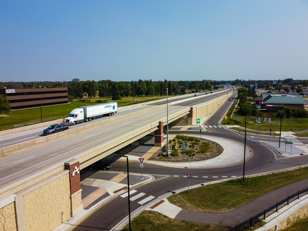
Hwy 7 study — Hopkins to St. Bonifacius
Study complete
About this study
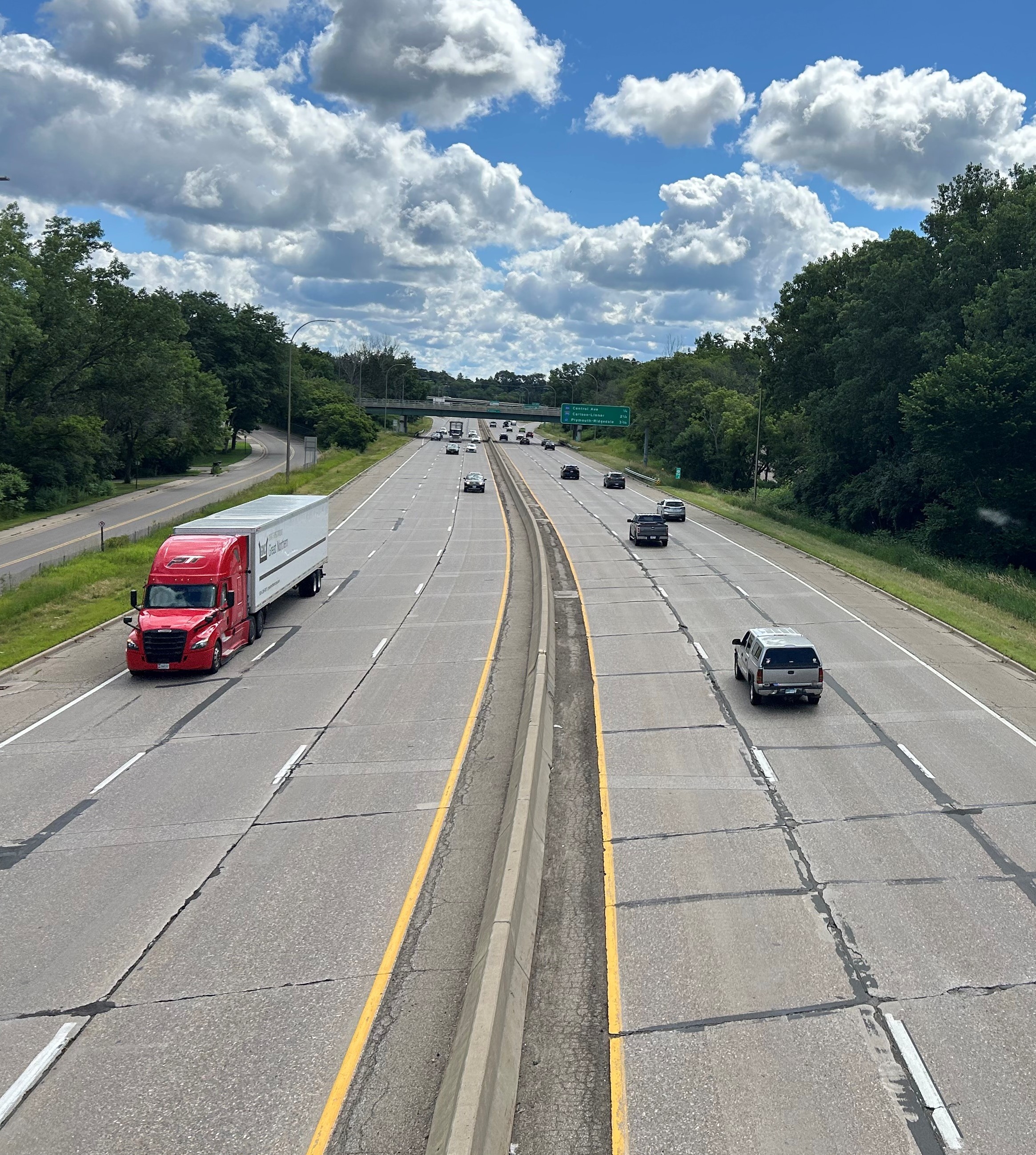
W View full-size mape have completed a planning study for an 18-mile stretch of Hwy 7 from St. Bonifacius to Hopkins.
We conducted this study to understand travel experiences of those walking, biking and driving on Hwy 7, identify the needs in the study area, and inform future transportation safety and mobility improvements on Hwy 7. The recommendations from this study will inform the design of a pavement resurfacing project planned for 2029 from the Hennepin/Carver County line in St. Bonifacius to Christmas Lake Rd. in Shorewood/Greenwood. Over the past two years, MnDOT worked with local partners and heard from community members to understand transportation needs and identify opportunities for future improvements.
Studies are an important part of transportation planning. They help identify needs, evaluate and recommend concepts to address those needs and allow the public to share their input. Studies do not make final design decisions, instead they guide and inform future transportation improvements the next phase of project development, which is preliminary design.
Read more about the study findings and next steps.
Stay engaged
We need your continued input so that future projects on Hwy 7 will meet the needs for safety, mobility and have better pedestrian/bicycle facilities.
- Sign up for email updates. If you’re already signed up for email updates from the study, you’ll continue to receive project updates for the preliminary design process scheduled to start later in 2026. If you’re not signed up yet, please sign up to get information on the upcoming project.
- Leave a comment or question
-
Study findings and next steps
Share Study findings and next steps on Facebook Share Study findings and next steps on Twitter Share Study findings and next steps on Linkedin Email Study findings and next steps linkThe planning study for Hwy 7 from St. Bonifacius to Hopkins has been completed. We conducted this study to understand travel experiences of those walking, biking and driving on Hwy 7, identify the needs in the study area, and inform future transportation safety and mobility improvements on Hwy 7. The recommendations from this study will also inform the design of a pavement resurfacing project planned for 2029 from the Hennepin/Carver County line in St. Bonifacius to Christmas Lake Rd. in Shorewood/Greenwood.
Who we heard from
During our public engagement process we heard from thousands of community members: over 6,900 surveyContinue reading
-
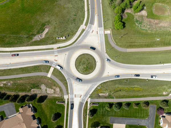
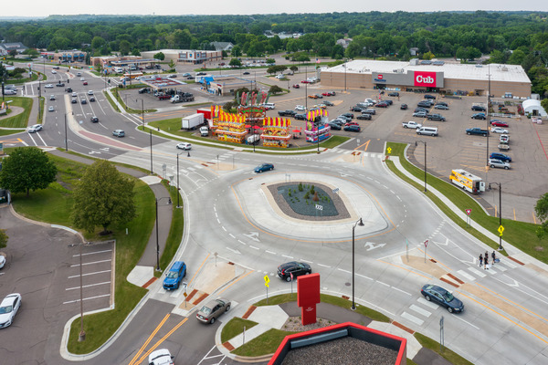
Recommended improvements
Share Recommended improvements on Facebook Share Recommended improvements on Twitter Share Recommended improvements on Linkedin Email Recommended improvements linkCommunity input and technical analysis were used to evaluate the design alternatives and help select the recommended improvements that are shared below.
Recommended improvements comment period
The comment period for the recommended improvements was open to the public from Oct. 22 to Nov. 30, 2025. In total, there were:
- 718 responses to the online comment form
- 70+ discussions held through two community pop-ups
- 66 email, phone and webpage submitted comments
Thank you to everyone who provided comments. Comments were reviewed and will be used to guide future design updates in the study area. Learn more about the study findings andContinue reading
-
Study design alternatives
Share Study design alternatives on Facebook Share Study design alternatives on Twitter Share Study design alternatives on Linkedin Email Study design alternatives linkWe created several design alternatives for Hwy 7 using the current conditions of the road, study area needs and public feedback. The alternatives have been broken down by segments because the study area spans an 18-mile stretch of road with different needs.
Segment 1 (Hwy 7 from the Hennepin/Carver County line in St. Bonifacius to Hwy 41 in Shorewood)
Segment 2 (Hwy 7 from Hwy 41 in Shorewood to the Baker Rd. interchange in Minnetonka)
Alternatives have only been developed from the Hennepin/Carver County line in St. Bonifacius to Baker Rd. interchange in MinnetonkaContinue reading
-
Engagement summary and study area needs
Share Engagement summary and study area needs on Facebook Share Engagement summary and study area needs on Twitter Share Engagement summary and study area needs on Linkedin Email Engagement summary and study area needs linkWe gathered feedback from the public on the current conditions along and across Hwy 7, including safety and mobility concerns with an online survey and comment map in June and July of 2024. Thank you to everyone who participated in the survey and comment map. Your feedback helped us understand your experiences of Hwy 7 and ideas for improvement. The survey and comment map closed on Sun, July 7, 2024. If you missed the deadline and would still like to submit your feedback, you can leave a comment or question or reach out to the Hwy 7 study team atContinue reading
-
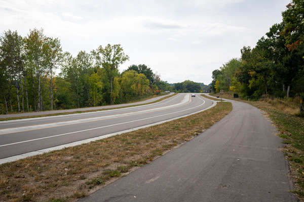
Accessibility
Share Accessibility on Facebook Share Accessibility on Twitter Share Accessibility on Linkedin Email Accessibility linkAmericans with Disabilities Act

Speakers and raised arrows on APS signals provide information about the intersection to pedestrians with hearing and visual impairment. All MnDOT projects - both new construction and rehabilitation projects - must include evaluation to ensure compliance with the Americans with Disabilities Act. Components can include, but are not limited to adding curb cuts, truncated domes and accessible pedestrian signals. Read about MnDOT's transition plan to comply with the ADA.
Specifics for this study
- Determine what accessibility improvements are needed for a 2029 resurfacing project


Contacts
-
MnDOT

Phone 651-234-7505 Email hwy.7.study.info@state.mn.us