Hwy 68 / Hwy 75 Canby Corridor Study

Share Hwy 68 / Hwy 75 Canby Corridor Study on Facebook Share Hwy 68 / Hwy 75 Canby Corridor Study on X (formerly Twitter) Share Hwy 68 / Hwy 75 Canby Corridor Study on Linkedin Email Hwy 68 / Hwy 75 Canby Corridor Study link

About this study:

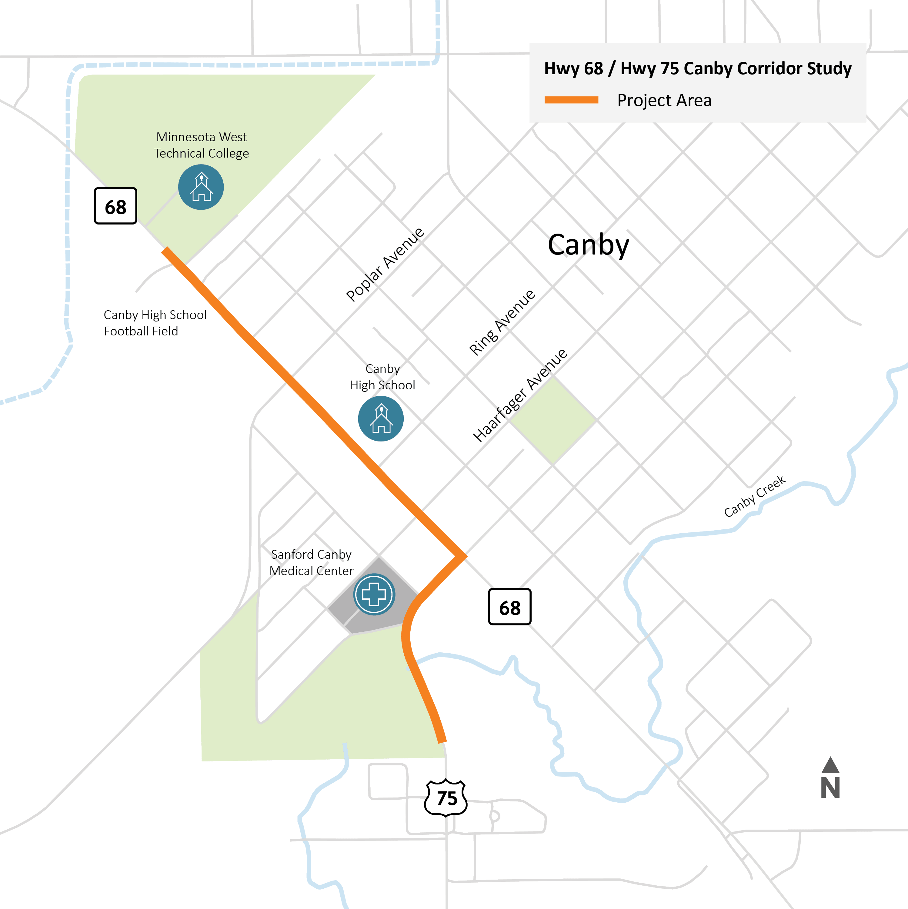
We are studying ways to improve safety, accessibility, and mobility along parts of Hwy 68 and Hwy 75 in Canby.

This study will:

  • Review current and future conditions for people walking, biking, driving, and using mobility devices.
  • Work with community members and local partners to understand transportation needs and priorities.
  • Look at ADA accessibility, intersection safety, traffic speeds, and visibility along the corridor.
  • Develop and compare potential roadway design options.
  • Recommend improvements that can be included in the 2030 Highway Safety Improvement Program (HSIP) to improve the corridor so it is safer and easier for everyone to use.

Tell us what you experience:

Share your insights, experiences, and questions to help inform this study with a corridor vision that best serves the community.

Illustrated map highlighting sections of Highway 68 and Highway 75 in the center of Canby.

Get involved

Use the comment box below to send us your questions and comments about the Hwy 68 / Hwy 75 Corridor Study in Canby. We’ll review all questions and comments and respond as we’re able.

About this study:

We are studying ways to improve safety, accessibility, and mobility along parts of Hwy 68 and Hwy 75 in Canby.

This study will:

  • Review current and future conditions for people walking, biking, driving, and using mobility devices.
  • Work with community members and local partners to understand transportation needs and priorities.
  • Look at ADA accessibility, intersection safety, traffic speeds, and visibility along the corridor.
  • Develop and compare potential roadway design options.
  • Recommend improvements that can be included in the 2030 Highway Safety Improvement Program (HSIP) to improve the corridor so it is safer and easier for everyone to use.

Tell us what you experience:

Share your insights, experiences, and questions to help inform this study with a corridor vision that best serves the community.

Illustrated map highlighting sections of Highway 68 and Highway 75 in the center of Canby.

Get involved

Use the comment box below to send us your questions and comments about the Hwy 68 / Hwy 75 Corridor Study in Canby. We’ll review all questions and comments and respond as we’re able.

  • Sidewalk Stickers

    Share Sidewalk Stickers on Facebook Share Sidewalk Stickers on X (formerly Twitter) Share Sidewalk Stickers on Linkedin Email Sidewalk Stickers link

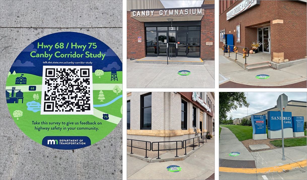
    Have you seen one of these large blue and green stickers around town? At four locations in the project area, you'll see custom decals directing people to visit this webpage and provide feedback using any of these tools:

    Canby Corridor safety survey.

    Canby project study map.

    Canby general questions form.


    Thank you to the staff and owners of these Canby destinations for their participation:

    • Canby High School Gymnasium
    • Canby Drug & Gifts
    • First Security Bank
    • Sanford Hospital

    Have you seen one of these large blue and green stickers around town? At four locations in the project area, you'll see custom decals directing people to visit this webpage and provide feedback using any of these tools:

    Canby Corridor safety survey.

    Canby project study map.

    Canby general questions form.


    Thank you to the staff and owners of these Canby destinations for their participation:

    • Canby High School Gymnasium
    • Canby Drug & Gifts
    • First Security Bank
    • Sanford Hospital
  • Field Walk Overview

    Share Field Walk Overview on Facebook Share Field Walk Overview on X (formerly Twitter) Share Field Walk Overview on Linkedin Email Field Walk Overview link

    In late August, a group of project team members, representatives from the City of Canby, Canby School District and Regional Development Commission conducted a Field Walk as part of the Hwy 68 / Hwy 75 Canby Corridor Study. The walk provided an opportunity to:

    1. Observe how residents, businesses, and visitors experience the corridor
    2. Help identify opportunities and inform future corridor improvement concepts related to safety, accessibility, and connectivity in the community.

    Participants noted several community assets, including local trail connections, recreational opportunities near Canby Creek, schools, businesses, and gathering places that contribute to community activity along the corridor.

    Observations and findings

    One theme emphasized by project partners was student and pedestrian safety, especially near Canby High School, the football field, and student destinations such as Casey’s General Store. Participants noted several locations where pedestrians frequently cross, including Haarfager Avenue, Poplar Avenue, Walnut Street, and areas near the school and football field. High-visibility crosswalks and pedestrian warning devices were suggested as potential safety improvements.
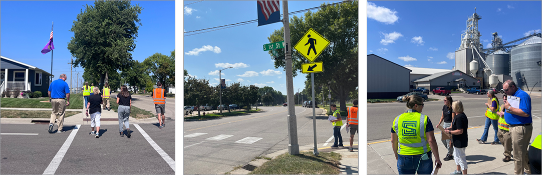
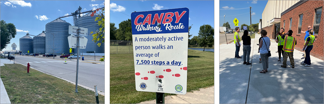
    Three photos of Field Walk participants in action.

    Attendees also expressed concern about vehicle speeds entering Canby, particularly along Hwy 68 from the west and Hwy 75 from the south. They discussed traffic-calming measures to improve driver awareness. Participants noted locations where drivers do not always follow stop signs or notice pedestrians, emphasizing the need for more visible crosswalks.
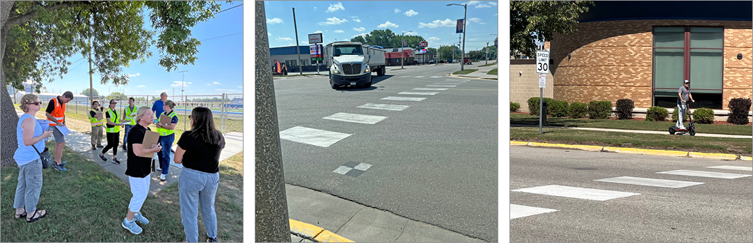
    Field Walk participants observing freight vehicles and a pedestrian on a scooter.

    Participants also noted the popularity of fishing near Canby Creek and the opportunity for improved pedestrian and bicycle trail connections. Stakeholders expressed interest in gateway features that could strengthen Canby's community identity. Feedback gathered during the Field Walk will be considered alongside technical analysis, traffic data, and additional public input as the project team develops and evaluates potential corridor improvement concepts.
    Landmarks and signage in Canby, MN.

    In late August, a group of project team members, representatives from the City of Canby, Canby School District and Regional Development Commission conducted a Field Walk as part of the Hwy 68 / Hwy 75 Canby Corridor Study. The walk provided an opportunity to:

    1. Observe how residents, businesses, and visitors experience the corridor
    2. Help identify opportunities and inform future corridor improvement concepts related to safety, accessibility, and connectivity in the community.

    Participants noted several community assets, including local trail connections, recreational opportunities near Canby Creek, schools, businesses, and gathering places that contribute to community activity along the corridor.

    Observations and findings

    One theme emphasized by project partners was student and pedestrian safety, especially near Canby High School, the football field, and student destinations such as Casey’s General Store. Participants noted several locations where pedestrians frequently cross, including Haarfager Avenue, Poplar Avenue, Walnut Street, and areas near the school and football field. High-visibility crosswalks and pedestrian warning devices were suggested as potential safety improvements.

    Three photos of Field Walk participants in action.

    Attendees also expressed concern about vehicle speeds entering Canby, particularly along Hwy 68 from the west and Hwy 75 from the south. They discussed traffic-calming measures to improve driver awareness. Participants noted locations where drivers do not always follow stop signs or notice pedestrians, emphasizing the need for more visible crosswalks.

    Field Walk participants observing freight vehicles and a pedestrian on a scooter.

    Participants also noted the popularity of fishing near Canby Creek and the opportunity for improved pedestrian and bicycle trail connections. Stakeholders expressed interest in gateway features that could strengthen Canby's community identity. Feedback gathered during the Field Walk will be considered alongside technical analysis, traffic data, and additional public input as the project team develops and evaluates potential corridor improvement concepts.

    Landmarks and signage in Canby, MN.

Page last updated: 17 Sep 2026, 05:48 PM