Share Hwy 61 Corridor Study - Little Marais to Tofte on FacebookShare Hwy 61 Corridor Study - Little Marais to Tofte on X (formerly Twitter)Share Hwy 61 Corridor Study - Little Marais to Tofte on LinkedinEmail Hwy 61 Corridor Study - Little Marais to Tofte link
About the Project
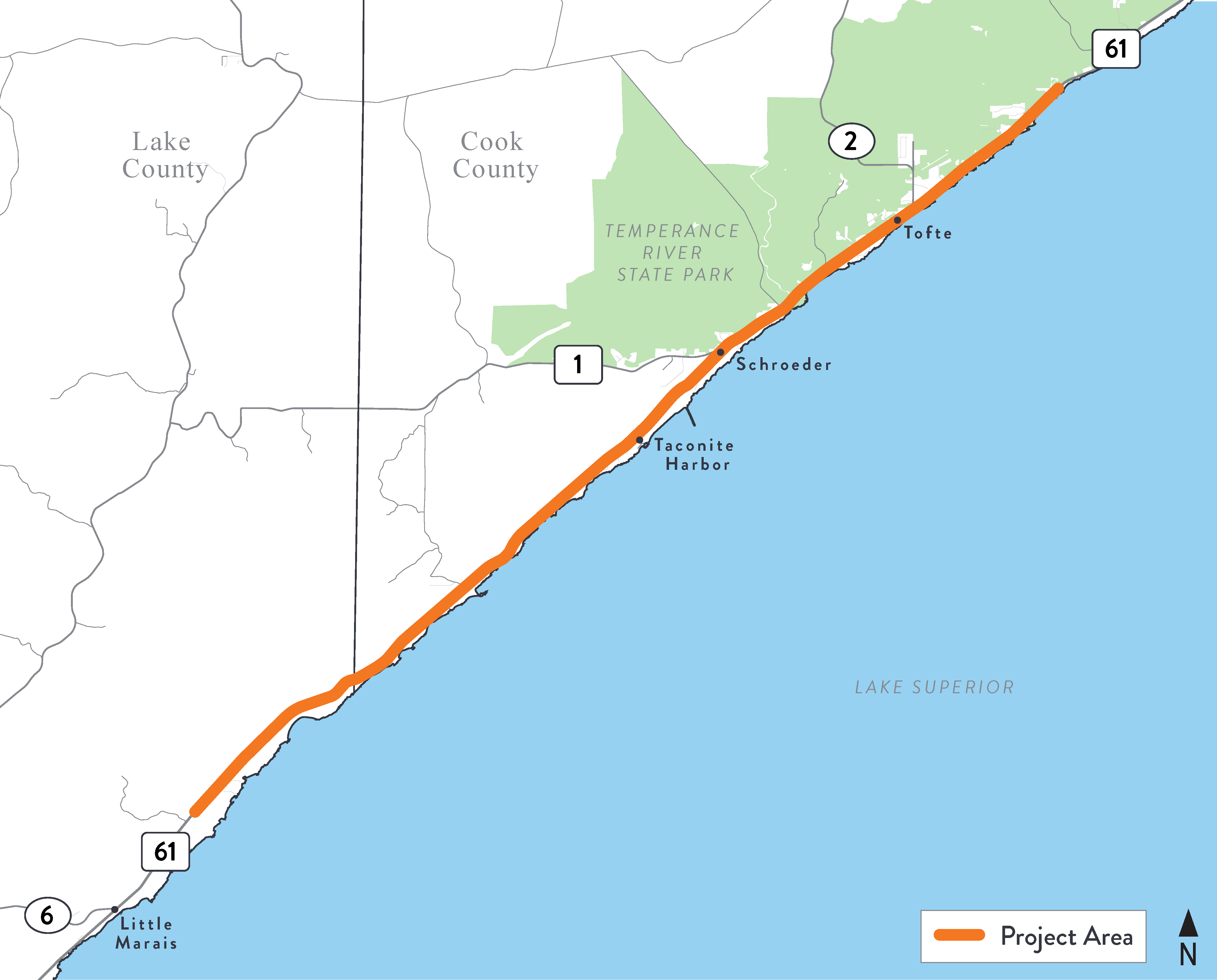
MnDOT is working to study and design future improvements for Highway 61 along the North Shore of Lake Superior in Lake and Cook Counties. The study area covers about 18 miles, from Little Marais to just north of Tofte.
This study will review the Highway 61 corridor from 2.6 miles north of Little Marais Road (CSAH 6) to 0.2 miles north of Leveaux Ridge Road. In addition to the corridor, the study will review safety concerns at pull-offs and waysides throughout the corridor and at the roadway curves near the Cook and Lake County Line.
The purpose of the study is to create a common vision and guidance for improving safety and efficiency for all users of the corridor. The study will identify and document corridor and community needs, develop and evaluate improvement alternatives, and provide corridor recommendations to increase safety for motorized and non-motorized travel into the future.
A resurfacing project to provide a smoother road surface in the meantime, upgrade guardrails, and make ADA improvements is scheduled for 2027. You can learn more about that construction here: Highway 61 pavement preservation.
Get involved
Thursday, August 20 Open House
An update meeting for 2027 construction work and long-range corridor study will be held Thursday, August 20 at 5 p.m. at the Schroeder Town Hall (124 Cramer Rd, Schroeder, MN 55613). Information presented at the meeting will be posted here afterwards.
MnDOT is working to study and design future improvements for Highway 61 along the North Shore of Lake Superior in Lake and Cook Counties. The study area covers about 18 miles, from Little Marais to just north of Tofte.
This study will review the Highway 61 corridor from 2.6 miles north of Little Marais Road (CSAH 6) to 0.2 miles north of Leveaux Ridge Road. In addition to the corridor, the study will review safety concerns at pull-offs and waysides throughout the corridor and at the roadway curves near the Cook and Lake County Line.
The purpose of the study is to create a common vision and guidance for improving safety and efficiency for all users of the corridor. The study will identify and document corridor and community needs, develop and evaluate improvement alternatives, and provide corridor recommendations to increase safety for motorized and non-motorized travel into the future.
A resurfacing project to provide a smoother road surface in the meantime, upgrade guardrails, and make ADA improvements is scheduled for 2027. You can learn more about that construction here: Highway 61 pavement preservation.
Get involved
Thursday, August 20 Open House
An update meeting for 2027 construction work and long-range corridor study will be held Thursday, August 20 at 5 p.m. at the Schroeder Town Hall (124 Cramer Rd, Schroeder, MN 55613). Information presented at the meeting will be posted here afterwards.
Hwy 61 Corridor Study - Little Marais to Tofte has finished this stage
Baseline Information: Engage the Townships, Counties, and community to gather information about the corridor through stakeholder and public meetings.
Spring – Summer 2026
Hwy 61 Corridor Study - Little Marais to Tofte is currently at this stage
Develop Corridor Vision and Alternatives: Take collected information and create a vision and concepts to be considered. Public feedback will be solicited on each of the possible concepts.
Summer – Fall 2026
this is an upcoming stage for Hwy 61 Corridor Study - Little Marais to Tofte
Preliminary Design: Determine final recommendations from concepts and feedback received. The final recommendation will be drafted and then presented.