
Hwy 11/71 International Falls Corridor Study
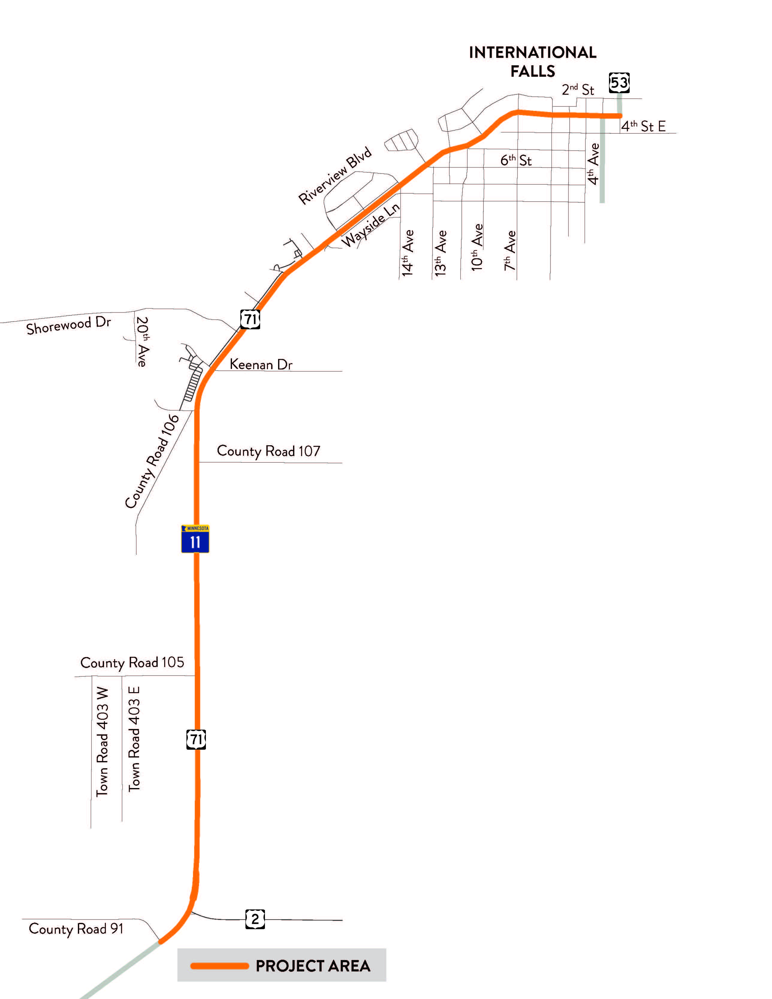
This study will review the Highway 11/71 corridor in International Falls from the intersection of Koochiching County Road 91 to Highway 53/2nd Avenue. In addition to the corridor, signalized intersections, multiple unsignalized intersections, and numerous private access points will also be reviewed.
The purpose of the study is to create a common vision and guidance for improving safety and efficiency for all users of the corridor. The study will identify and document corridor and community needs, develop and evaluate improvement alternatives, and provide intersection and corridor recommendations to increase safety for motorized and non-motorized travel into the future.
Study Recommendations
See the informational boards presented here (PDF)
Downtown layout recommendation (PDF)
Neighborhood layout recommendation (PDF)
Commercial District layout recommendation (PDF)
Rural residential layout recommendation (PDF)
Full layout recommendation (PDF)
Project recommendation summary document (PDF)
Watch a video of the Aug. 18, 2026 presentation (Youtube)
Information Presented at the Feb. 10, 2026 public meeting
See the informational boards presented here (PDF)
Downtown layout alternatives (PDF)
Neighborhood layout alternatives (PDF)
Commercial District layout alternatives (PDF)
Rural residential layout alternatives (PDF)
Watch a video recording of the presented information (Youtube)
Past meetings
Sept. 16, 2025 public meeting information
-

Phone 218-348-7013 Email alex.peritz@state.mn.us -

Phone 218-576-8155 Email Christian.Lawien@state.mn.us -

Phone 218-390-4604 Email margie.nelson@state.mn.us